- Home
- Patrick Robinson
Scimitar SL-2 (2004) Page 34
Scimitar SL-2 (2004) Read online
Page 34
“How accurate does his damn missile have to be?”
“If it’s nuclear, which we’re sure it will be, he can hit within a half-mile of the Cumbre Vieja, and the impact would be terrific. But I think he’ll try to bury those babies right in the crater. Remember, he’s trying to blow the volcano wide open. He’s not trying to knock the cliff down…because that won’t be enough. He’s vowed to erupt the Cumbre Vieja, and he’ll need time to set up for an accurate fix. And that’s our chance…while his periscope’s jutting out of the water, and we’re sweeping the surface with radar.”
“There’s a lot riding on this, Frank,” said the President. “A whole lot riding on the skill and sharpness of your boys.”
“Yes, sir. But if it can be done, they’ll do it. Of that I’m in no doubt.”
President Bedford and Admiral Morgan refused all requests for interviews via the White House Press Office. There was a hot line established between the National Security Agency and the Oval Office. And Lieutenant Commander Ramshawe was constantly combing the myriad of U.S. intercepts for anything that might give a clue to the whereabouts of the phantom Barracuda.
At eleven o’clock on the first morning of Paul Bedford’s Presidency, he got one—vague, coded, and not much use to anyone. But the U.S. listening station in the Azores had picked up something that arrived from the satellite of the Chinese Navy’s Southern Fleet. A short signal transmitted at 0500 (DST) on Tuesday morning…a cruel sea for the songbirds.
There was something about it that caught Ramshawe’s attention. He stared at it, pondered its possible meaning. Cruel sea…a cruel sea…the cruel sea…novel about the Navy…Nicholas Montserrat! Holy shit! On the day the island volcano blew.
Lieutenant Commander Ramshawe did not have the slightest idea of the different spelling. This may have been a message from anyone, to anyone. But it was in English, and it was on the Chinese Navy satellite. And it must have meant something to somebody.
So who’s the bloody songbirds? He did not waste any more time thinking. He picked up the phone to his boss, Admiral George Morris, and recounted the signal. George thought slowly. Eventually he spoke. “Jimmy,” he said. “That’s very interesting. Especially if those songbirds turned out to be canaries.”
“Hey! That’s a beaut, sir. You got it. Can’t be sure what it means, but it surely suggests the bloody Barracuda is on its way to La Palma.”
Neither of them knew that a new signal had just hit the Chinese satellite. Again brief…RAZORMOUTH 71.30N 96.00E. General Rashood, operating from Bandar Abbas, did not yet think that the Americans had already cracked the Barracuda/Razormouth code many months previously. And in any case, the Americans, who picked up the new signal, would not understand the coded global positions. The code 71.30N 96.00E put the submarine somewhere in the landlocked foothills of the North Siberian Plain.
They should have read 21.30N (minus 50 degrees) 48.00W (divided by 2). Which put the Barracuda precisely where Admiral Badr had her…steaming at 15 knots hard above the eastern shoulders of the North Atlantic Ridge, right over the Kane Fracture Zone, more than 900 miles east nor’east of the island of Montserrat. She was making a beeline for the Canary Islands.
When he went deep again after his transmission, Ben Badr would order a reduction in speed down to nine knots in 600 feet, above the somewhat noisy waters of the Ridge. He would cut it further as they continued eastward, running softly over the quiveringly sensitive underwater wires of SOSUS.
“Well, Admiral,” he said, “At least we know where the little bugger is headed. You want to call the Big Man, or will I do it?”
“You go ahead, Jimmy…I’m just looking over the comms plan for the command ship…We’re using the Coronado, an old warhorse, newly converted.”
He referred to the 17,000-ton Austin-class former Landing Platford Ship, which acted as Flagship Middle East Force in 1980. The Coronado was the U.S. Navy’s Flagship in the first Gulf War, and Flagship to the Third Fleet in Hawaii in the 1980s.
Commissioned in 1970, she had undergone three major conversions in a long life. A massive rebuild in the late 1990s saw her emerge virtually brand new. They turned her well deck into offices, with a three-deck command facility, and accommodation for four Flag Officers.
She was twin-shafted, driven by a couple of turbines that generated 24,000 hp. All her combat data systems were state-of-the-art, including an automated planning air-control system and wide-band commercial. She used Raytheon SPS-10P plus G-Band for surface search, and carried two helicopters.
After the turn of the century, the Coronado became the U.S. Navy’s sea-based Battle Lab, to act as test bed for new Information Technology systems.
At nine o’clock that morning, the CNO Adm. Alan Dickson announced from the Pentagon that Rear Adm. George Gillmore, a former hunter-killer nuclear submarine CO, had been appointed Search Group Commander, Task Group 201.1. He would report only to Adm. Frank Doran (CTF 201—CINCLANT), who now represented the Front Line contact, through which Arnold Morgan would remain close to all developments off the Canaries.
Admiral Gillmore had been the outstanding submariner of his year, along with Capt. Cale “Boomer” Dunning, a fellow Commanding Officer from Cape Cod. When he took his first surface ship command aboard the frigate Rodney M. Davis, George had quickly proved one of the best ASW officers in the Navy, in a class of his own in almost every exercise.
He had all the right qualities, including the ability to concentrate for hours at a time, the sharpness to react instantly to even a sniff of an underwater contact, and the courage to act decisively when he was sure he’d found one. His long years underwater served him well. Admiral Gillmore could always recollect what he would have done, had he been the hunted rather than the hunter. And he had an almost uncanny knack of being correct in his predictions. Bad news for Admiral Badr and his men.
A tall, bearded disciplinarian, George was based in the Atlantic Fleet, and he had already sailed for the Canaries from Norfolk in the small hours of Wednesday morning two days previously, several hours before President McBride left the White House. It was the fact that such an act of open defiance towards a sitting President had been necessary that had convinced Admiral Morgan and General Scannell that McBride simply had to go.
Admiral Gillmore’s overall task would be to coordinate the search frigates, helos, and the Carrier Battle Group ships in an intense and complicated operation that might explode into action at any moment. He would have a staff of more than one hundred men, eighteen officers.
Right now, as the announcement was made, Admiral Gillmore was familiarizing himself with the new systems on board the Coronado. He was assisted by two Lieutenant Commanders and three Lieutenants as he toured the ship’s ops rooms, checking the comms, the sonar room, the radar, the navigation area, and the GPS, which he alone knew would go dark at midnight on Wednesday, October 7.
The Navy Press Office issued a release to the media announcing the appointment of Admiral Gillmore, but a few doors down the corridor, in the Office of the CNO, there was a major disturbance. They had just received a communiqué from the French. On no account would they close down the European GPS. They cited the consequences to the world’s shipping, the obvious hazards to yachtsmen, and the prospect of beached freighters and tankers. They could not, in conscience, agree to such a course of action.
Immediately, Admiral Dickson prepared to go to Plan B, which would entail Admiral Morgan speaking to—or yelling at—the French Foreign Minister on a direct line to Paris.
Admiral Dickson was quite certain that the American Admiral was capable of frightening the French into submission, which, under the circumstances, would be a wise course of action. There was no question in Alan Dickson’s mind that Arnold would blow the Helios satellite clean out of the stratosphere if there was not immediate cooperation from France.
As the evacuation process continued, it quickly emerged that Washington’s treasures posed a huge problem, mainly because the capital city was entr
usted with the preservation of the national heritage, and all that the nation holds dear. Of the 750,000 residents of Washington, D.C., 70 percent were employed by the Federal Government, which meant that a broad structure was already in existence for easy dissemination of information and execution of the evacuation plans.
The greatest concern by far, in the city itself, was the vast range of fine art, documents, and items of priceless value that record the birth, development, and history of the nation.
Across the Potomac, a Special Ops Room was established inside the Pentagon in the U.S. Navy department. A large computerized screen occupied an entire wall, and two Lieutenant Commanders were marking out the west-nor’westerly direction of the incoming tsunami as it would come driving forward off the Atlantic. So far as they could tell, the one certainty was that the initial impact would be borne by the peninsula of land stretching south from Salisbury.
The path of the tsunami would proceed straight across the outer islands, on to the eastern shore of Maryland, a 150-foot wave taking out Salisbury completely. From there it would roll clean across the flatlands, drowning the Blackwater National Wildlife Refuge, and into the wide estuary of Chesapeake Bay. Speed: approximately 300 mph, causing massive flooding all the way north up the main channel and causing a tidal surge up the Potomac of 120 feet minimum, IF the jutting headland of Pautuxet was able to remove some of the sting from the wave. By now it would have leveled probably fifty small towns and villages.
Minutes later, the great city of Washington, D.C., would go under water. Scientists on the line from the University of California were telling the Pentagon Ops Room they could expect a rise of at least 50 feet throughout the course of the Potomac River as far upstream as Bethesda, where it should begin to decrease to maybe 20 feet, up near Brunswick.
The waters would, of course, recede within a few days, but the damage would be inestimable, and on no account should anything be left to chance. Washington itself was particularly low-lying; indeed, the Lincoln and Jefferson Memorials were built on land that was formerly a swamp. Some of the great city buildings might survive, but not many, and no human being should risk standing in the way of the tidal wave.
The Treasury, the Supreme Court, the Department of Defense, and the FBI were effectively out of action for any new business. The CIA, perilously situated just north of the Georgetown Pike, on the west bank of the Potomac, where the river sweeps downstream to the right, was beginning a massive salvage operation of some of the most sensitive documents in the country, not to mention the kind of high-value equipment and files that could cause a world war, should they wash up in the wrong place.
Like their colleagues in Federal Government offices, the CIA were packing and dispatching computers, hard drives, documents, archive material, and other valuable records. Departmental staff were packing the stuff into military cases, all numbered and recorded, before making the journey under armed guard to Andrews Air Force Base over in Prince George’s County. From there they would be flown under guard in the giant C-17 transporters to carefully selected U.S. Air Bases beyond the reach of the floodwaters. Those cases would be stored in Air Force hangars, closely guarded around the clock by Federal troops with orders to shoot intruders on sight.
Over on Independence Avenue
there was a major operation in the Library of Congress. Things had been relatively calm in there since they moved into their new building in 1897. But the Library was no stranger to catastrophe, having twice burned down when it was located in the Capitol in the first half of the nineteenth century. Today, the activity was close to frenzied, as troops from the Air Force Base joined the staff, trying to pack up more than 84 million items of information, in 470 languages.
This was the world’s largest library; its books, pamphlets, microfilm, folios of sheet music, and maps were all stored in three great stone centers of learning, each one named after three of the Founding Fathers who all were Presidents—the main Thomas Jefferson Building, lavishly decorated in Italian Renaissance style; the James Madison Memorial Building; and the John Adams Building, all located to the rear of the U.S. Supreme Court.
Into big packing cases, the troops and the permanent Library staff were bundling the first volumes of the most priceless sources of information in the entire country—the fountain of knowledge used by Congressmen, Senators, and selected researchers from all over the world.
To complicate the task still further, the U.S. Copyright Office, with its unique store of critical business data, is also located there. It would take twenty-four-hour shifts every day, until the ocean crushed the city, to move even half of the contents of the great buildings on Independence Avenue
.
Over on Constitution Avenue
, behind the giant stone columns of the National Archives, a more delicate operation was under way. Curators and troops were working in the midst of this ultimate repository for all U.S. Government documents, packing up documents beyond price—the Declaration of Independence, the Constitution, the Bill of Rights—all destined for Andrews Air Force Base, from where they would be flown to secure U.S. military establishments, and guarded night and day.
Up on 14th and C Streets there was a total evacuation from the U.S. Bureau of Engraving and Printing, where $35 million of U.S. Government banknotes were printed every day, just to replace the old ones. In here they also printed postage stamps, government bonds, licenses, and revenue stamps. There was a U.S. Marine guard of more than one hundred men forming a cordon around this building while the presses were being dismantled and crucial components carried out to the waiting trucks.
All along Washington’s imposing Mall, the story was the same. The evacuation was under way. Military trucks lined the avenues, parked two deep outside the Capitol itself, and similarly inside the grounds of the White House. Historic portraits, ornaments, furnishings, and furniture were being loaded by Marines along with Presidential papers and records.
Critical offices of government remained open, and inside the Oval Office, Admiral Morgan and Admiral Frank Doran wrestled with the problem of the United States Navy’s warships. They had to be removed, fast, from all dockyards on the East Coast, or else they would surely be smashed to rubble. And they could not be headed east to assist with the submarine operation around the Canaries, not into the jaws of the tsunami. They had to be sent into calmer waters, and the two Admirals pored over the charts. Not even the submarine jetties up in New London, Connecticut, were safe.
And certainly it was too great a risk to send several billion dollars worth of nuclear submarines into deep waters in the hopes that the huge waves of the tsunami would simply roll over them. No one knew the depth of the turbulence that might accompany such a wave, subsurface, and it was clear that the submarines would have to follow the same route as the East Coast–based frigates, destroyers, aircraft carriers, and the like, into a sheltered anchorage.
Frank Doran had considered the possibility of running the ships north, into the 30-mile-wide Bay of Fundy, which divides southern Nova Scotia from the Canadian mainland in New Brunswick.
“There’s no problems with ice up there at this time of year,” he said. “We could push the fleet north as far as Chignecto Bay…That’d put a hilly hunk of land 60 miles wide between the ships and the Atlantic. They’d be safe in there.”
But Arnold did not trust the surge of the waves from the southwest, and he was afraid the tsunami might curl around the headland of Fundy, and then roll up the bay, dumping ships on the beach. There would be no possibility of escape in the shallow, confined waters of the Chignecto, and generally speaking, Admiral Morgan preferred to send the fleet south.
“But the Caribbean may be under worse threat than anywhere,” said Frank. “This document we have here from the University of California says the tidal wave will hit the coast of Mexico, never mind Florida.”
“I know,” said Admiral Morgan. “But Florida’s a very big chunk of land. It’s more than 100 miles wide, even at its narrowest, and t
he scientists do not expect the tidal wave to last much more than 12 or 15 miles at most, once it hits land. I’m saying we should get the fleet south, around the Keys and then north into the Gulf of Mexico, maybe up as far as Pensacola…anywhere there’s deep water along that Gulf Coast…because there’s got to be shelter under the armpit of Florida…Are you with me?”
“I am,” said Admiral Doran. “And like all sailors, I’d rather go south than north.”
“You’re not going anywhere,” said Arnold Morgan, “except to your office in Norfolk. And you’ll be running the show till those missiles come bursting out of the ocean—that is, if your boys don’t nail him first. I just wish they were attacking from anywhere else on earth, rather than a nuclear submarine. Anywhere, anything. I’d rather they were attacking from outer space than from a nuclear boat, submerged-launch.”
“So would I,” replied Admiral Doran. “Meanwhile I’d better get back down to Norfolk. Every time I look at the place I think ‘tidal wave,’ and the havoc it would cause down there. That thing could pick up a 100,000-ton carrier, according to the scientific assessments. And if it didn’t do that, it would most likely crush the big ships against the jetties.

 H.M.S. Unseen am-3
 The Shark Mutiny (2001)
 Hunter Killer am-8
 The Shark Mutiny am-5
 Scimitar SL-2
 Barracuda 945 am-6
 Hunter Killer
 Ghost Force
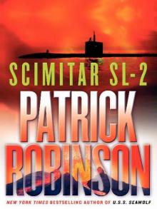 Scimitar SL-2 (2004)
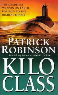 Kilo Class am-2
 The Lion of Sabray
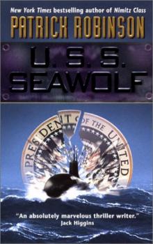 U.S.S. Seawolf am-4
 Ghost Force am-9
 To the Death am-10
 The Shark Mutiny
 Nimitz Class am-1
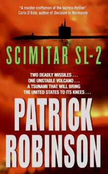 Scimitar SL-2 am-7
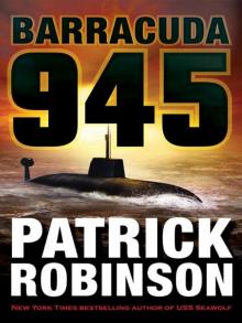 Barracuda 945
 Intercept
 Nimitz Class (1997)
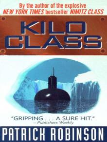 Kilo Class
 Kilo Class (1998)
 Diamondhead
 H.M.S. Unseen
 Barracuda 945 (2003)
 Nimitz Class
 The Delta Solution
 U.S.S. Seawolf